Jump to content

Recommended Posts

Anything happening in Oswego? Any tips on where to start? Haven't been up there in a couple weeks and see charters posting some laker and brown pics which usually isnt a great sign. Also where would be good place for Lakers in Oswego? I can find them out of Mexico but not experienced for Lakers in Oswego,,,thanks for any help,,I'm taking kids out.

Edited by seeyawader
Link to comment
Share on other sites

One very important thing happened.

A wave height /water temperature buoy about half a mile out of Oswego.

While it always was a guessing game about wave height and  wave period, Now there is on the spot real time info. So now, we can decide at home before we load  up and go only to find out that the weather man was wrong about wave height.. This additional info source is great

Station 45215 - Oswego, NY (274) Image indicating link to RSS feed of recent meteorological observations for station 45215

Information submitted by Scripps Institution of Oceanography
Waverider Buoy
43.501 N 76.539 W (43°30'3" N 76°32'19" W)

Air temp height: 0 m above site elevation
Sea temp depth: 0.46 m below water line
Water depth: 40 m

Latest NWS Marine Forecast

Search And Rescue (SAR) Data

Meteorological Observations from Nearby Stations and Ships Image indicating link to RSS feed of recent meteorological observations near station 45215

Map Type:
 
Zoom in
Zoom out


CHS, Esri, GEBCO, Garmin, NaturalVue | CHS, Esri, GEBCO, Garmin, NGS
Powered by Esri
 
Large icon indicates selected station.
yellow diamond Stations with recent data
red diamond Stations with no data in last 8 hours
(24 hours for tsunami stations)
Station 45215

Refresh page every 10 minutes:


Conditions at 45215 as of
(12:56 pm EDT)
1656 GMT on 08/02/2024:
Unit of Measure:

   Time Zone:   

Click on the graph icon in the table below to see a time series plot of the last five days of that observation.

5-day plot - Wave Height Wave Height (WVHT): 0.3 ft
5-day plot - Average Wave Period Average Period (APD): 2.3 sec
5-day plot - Air Temperature Air Temperature (ATMP): 77.5 °F
5-day plot - Water Temperature Water Temperature (WTMP): 77.2 °F
 
 
Previous observations
TIME
(EDT)
5-day plot - Wind Direction
WDIR
 
5-day plot - Wind Speed
WSPD
kts
5-day plot - Wind Gust
GST
kts
5-day plot - Wave Height
WVHT
ft
5-day plot - Dominant Wave Period
DPD
sec
5-day plot - Average Wave Period
APD
sec
5-day plot - Mean Wave Direction
MWD
 
5-day plot - Atmospheric Pressure
PRES
in
5-day plot - Pressure Tendency
PTDY
in
5-day plot - Air Temperature
ATMP
°F
5-day plot - Water Temperature
WTMP
°F
5-day plot - Dew Point
DEWP
°F
5-day plot - Salinity
SAL
psu
5-day plot - Visibility
VIS
nmi
5-day plot - Tide (above MLLW)
TIDE
ft
2024-08-02 12:26 pm - - - - - - - - - 77.4 77.2 - - - -
2024-08-02 11:56 am - - - 0.3 - 2.5 - - - 76.8 77.2 - - - -
2024-08-02 11:26 am - - - - - - - - - 75.9 77.4 - - - -
2024-08-02 10:56 am - - - - - - - - - 75.9 77.0 - - - -
2024-08-02 09:56 am - - - 0.3 - 2.2 - - - 75.4 76.8 - - - -
2024-08-02 09:26 am - - - 0.3 - 2.3 - - - - 76.6 - - - -
2024-08-02 08:56 am - - - 0.3 - 2.3 - - - 75.2 76.3 - - - -
2024-08-02 08:26 am - - - 0.3 - 2.5 - - - 74.1 76.3 - - - -
2024-08-02 07:56 am - - - - - - - - - 74.1 76.3 - - - -
2024-08-02 07:26 am - - - - - - - - - 74.3 76.3 - - - -
2024-08-02 06:56 am - - - - - - - - - 73.9 76.3 - - - -
2024-08-02 06:26 am - - - - - - - - - 73.8 76.3 - - - -
2024-08-02 05:56 am - - - 0.7 - 2.2 - - - 73.6 76.3 - - - -
2024-08-02 05:26 am - - - - - - - - - 73.8 76.5 - - - -
2024-08-02 04:56 am - - - - - - - - - 74.1 76.6 - - - -
2024-08-02 04:26 am - - - 0.3 - 2.4 - - - 74.7 76.8 - - - -
2024-08-02 03:56 am - - - 0.3 - 2.4 - - - 74.5 77.0 - - - -
2024-08-02 03:26 am - - - 0.3 - 2.4 - - - 74.5 77.0 - - - -
2024-08-02 02:56 am - - - 0.3 - 2.4 - - - 75.6 77.2 - - - -
2024-08-02 02:26 am - - - 0.3 - 2.4 - - - 74.7 77.2 - - - -
2024-08-02 01:26 am - - - 0.3 - 2.5 - - - 74.8 77.4 - - - -
2024-08-02 12:56 am - - - 0.3 - 2.5 - - - 74.5 77.4 - - - -
2024-08-02 12:26 am - - - 0.3 - 2.6 - - - 74.8 77.4 - - - -
2024-08-01 11:26 pm - - - 0.3 - 2.6 - - - 76.5 77.5 - - - -
2024-08-01 10:56 pm - - - 0.3 - 2.7 - - - 76.1 77.5 - - - -
2024-08-01 09:56 pm - - - 0.3 - 2.7 - - - 76.5 77.7 - - - -
2024-08-01 09:26 pm - - - 0.3 - 2.7 - - - 76.8 77.9 - - - -
2024-08-01 08:56 pm - - - 0.7 - 2.6 - - - 77.2 78.1 - - - -
2024-08-01 08:26 pm - - - 0.7 - 2.6 - - - 77.5 78.4 - - - -
2024-08-01 07:56 pm - - - 0.7 - 2.6 - - - 78.1 78.6 - - - -
2024-08-01 07:26 pm - - - 0.7 - 2.7 - - - 78.4 79.0 - - - -
2024-08-01 06:56 pm - - - 0.7 - 2.7 - - - 78.8 79.2 - - - -
2024-08-01 06:26 pm - - - 0.7 - 2.7 - - - 79.2 79.3 - - - -
2024-08-01 05:56 pm - - - 0.7 - 2.6 - - - - 79.2 - - - -
2024-08-01 05:26 pm - - - 0.7 - 2.6 - - - - 78.8 - - - -
2024-08-01 04:56 pm - - - 0.7 - 2.6 - - - - 77.9 - - - -
2024-08-01 04:26 pm - - - 0.7 - 2.6 - - - 78.1 78.4 - - - -
2024-08-01 03:56 pm - - - 1.0 3 2.6 WSW - - 77.5 77.5 - - - -
2024-08-01 03:26 pm - - - 1.0 3 2.6 WSW - - 77.2 77.7 - - - -
2024-08-01 02:56 pm - - - 1.0 3 2.6 WSW - - 76.8 77.4 - - - -
2024-08-01 02:26 pm - - - 1.0 3 2.6 WSW - - 76.6 76.8 - - - -
2024-08-01 01:56 pm - - - 1.0 3 2.6 WSW - - 76.3 76.8 - - - -
2024-08-01 01:26 pm - - - 1.0 3 2.7 WSW - - 75.9 76.5 - - - -
2024-08-01 12:56 pm - - - 1.3 3 2.7 WSW - - 75.7 75.9 - - - -

Detailed Wave Summary
for 45215 as of (12:56 pm EDT)
1656 GMT on 08/02/2024:

These wave data are displayed in rounded times.

Unit of Measure:

   Time Zone:   

Click on the graph icon in the table below to see a time series plot of the last five days of that observation.

5-day plot - Significant Wave Height Significant Wave Height (WVHT): 0.3 ft
5-day plot - Swell Height Swell Height (SwH): 0.0 ft
5-day plot - Swell Period Swell Period (SwP): 25.0 sec
5-day plot - Swell Direction Swell Direction (SwD): SSE
5-day plot - Wind Wave Height Wind Wave Height (WWH): 0.3 ft
5-day plot - Wind Wave Period Wind Wave Period (WWP): 2.0 sec
5-day plot - Wind Wave Direction Wind Wave Direction (WWD): E
5-day plot - Average Wave Period Average Wave Period (APD): 2.3 sec
Previous observations
TIME
(EDT)
5-day plot - Wave Height
WVHT
ft
5-day plot - Swell Height
SwH
ft
5-day plot - Swell Period
SwP
sec
5-day plot - Swell Direction
SwD
 
5-day plot - Wind Wave Height
WWH
ft
5-day plot - Wind Wave Period
WWP
sec
5-day plot - Wind Wave Direction
WWD
 
5-day plot - Wave Steepness
STEEPNESS
 
5-day plot - Average Wave Period
APD
sec
2024-08-02 11:56 am 0.3 0.0 22.2 WNW 0.3 2.1 SW N/A 2.5
2024-08-02 09:56 am 0.3 0.0 22.2 N 0.3 2.1 WNW N/A 2.2
2024-08-02 09:26 am 0.3 0.0 25.0 NW 0.3 2.2 WSW N/A 2.3
2024-08-02 08:56 am 0.3 0.0 25.0 WSW 0.3 2.2 SW N/A 2.3
2024-08-02 08:26 am 0.3 0.0 22.2 NNW 0.3 4.0 W N/A 2.5
2024-08-02 05:56 am 0.7 0.0 25.0 SSE 0.7 2.3 S N/A 2.2
2024-08-02 04:26 am 0.3 0.0 25.0 ESE 0.3 2.3 WNW N/A 2.4
2024-08-02 03:56 am 0.3 0.0 25.0 SE 0.3 2.2 WNW N/A 2.4
2024-08-02 03:26 am 0.3 0.0 28.6 E 0.3 2.3 WNW N/A 2.4
2024-08-02 02:56 am 0.3 0.0 25.0 SW 0.3 2.5 WNW N/A 2.4
2024-08-02 02:26 am 0.3 0.0 25.0 ENE 0.3 2.4 W N/A 2.4
2024-08-02 01:26 am 0.3 0.0 25.0 WNW 0.3 2.6 W N/A 2.5
2024-08-02 12:56 am 0.3 0.0 25.0 S 0.3 2.9 W N/A 2.5
2024-08-02 12:26 am 0.3 0.0 25.0 SW 0.3 2.9 W N/A 2.6
2024-08-01 11:26 pm 0.3 0.0 22.2 SW 0.3 2.9 W N/A 2.6
2024-08-01 10:56 pm 0.3 0.0 25.0 W 0.3 2.9 W N/A 2.7
2024-08-01 09:56 pm 0.3 0.0 22.2 W 0.3 2.9 WSW N/A 2.7
2024-08-01 09:26 pm 0.3 0.0 25.0 NNW 0.3 3.0 WSW N/A 2.7
2024-08-01 08:56 pm 0.3 0.0 25.0 WNW 0.3 2.9 WSW N/A 2.6
2024-08-01 08:26 pm 0.7 0.0 25.0 ESE 0.7 2.9 WSW N/A 2.6
2024-08-01 07:56 pm 0.3 0.0 25.0 NNW 0.3 2.6 WSW N/A 2.6
2024-08-01 07:26 pm 0.7 0.0 22.2 NW 0.7 2.9 W N/A 2.7
2024-08-01 06:56 pm 0.7 0.0 25.0 NNW 0.7 2.9 W N/A 2.7
2024-08-01 06:26 pm 0.7 0.0 28.6 SSE 0.7 2.9 WSW N/A 2.7
2024-08-01 05:56 pm 0.7 0.0 25.0 W 0.7 2.6 W N/A 2.6
2024-08-01 05:26 pm 0.7 0.0 20.0 WSW 0.7 3.0 WSW N/A 2.6
2024-08-01 04:56 pm 0.7 0.0 25.0 W 0.7 3.2 WSW N/A 2.6
2024-08-01 04:26 pm 0.7 0.0 25.0 WNW 0.7 3.0 W N/A 2.6
2024-08-01 03:56 pm 0.7 0.0 22.2 W 0.7 2.9 WSW N/A 2.6
2024-08-01 03:26 pm 1.0 0.0 22.2 W 1.0 2.9 WSW N/A 2.6
2024-08-01 02:56 pm 1.0 0.0 25.0 WSW 1.0 3.0 WSW N/A 2.6
2024-08-01 02:26 pm 1.0 0.0 28.6 W 1.0 3.1 WSW N/A 2.6
2024-08-01 01:56 pm 1.0 0.0 25.0 WSW 1.0 3.1 WSW N/A 2.6
2024-08-01 01:26 pm 1.0 0.0 25.0 WSW 1.0 3.2 WSW N/A 2.7
2024-08-01 12:56 pm 1.3 0.0 25.0 SW 1.3 3.1 WSW N/A 2.7

Plot of wave energy versus frequency (and period)


Description of Measurements

Links which are specific to this station are listed below:

Real Time Data in tabular form for the last forty-five days.

Historical Data & Climatic Summaries for quality controlled data for prior months and year

.

Edited by rolmops
Link to comment
Share on other sites

I fished between Mexico and Oswego today. First skunk of the year. 


Fish finder was blank all day. Did run into lots of bait around 80FOW, with lots of marks picking them off (probably browns) The kings are moving a lot. They weren't were I found them last week. Some chatter on the radio this morning that the Kings were far north of the salmon river. Going to make a run up there tomorrow morning. Not quite an Oswego report, sorry.

Link to comment
Share on other sites

I fished from 60-300 today in Oswego. Didn’t pick up a fish till we hit 70’ looking for browns. Piles of bait in 60 degree water at 70’. Only action was a double, one 7 lb brown and one 14 lb king. Both on downriggers with spoons. Nothing on leadcore or dipseys. Washing spoons most of the day. At the fish cleaning station charter captains were bringing in coolers of salmon so they found them somewhere. 

Link to comment
Share on other sites

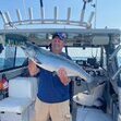
Thanks for responses, went 2 for 4 out of Oswego. Was a grind washing lures for a long time. Saw the piles of bait in shallow. Screens were pretty blank most of the day.

Link to comment
Share on other sites

Oswego is fishing well for kings but its an offshore bite rather than on the inside right now.  We did somewhere north of 60 bites between Friday and Saturday (Friday being a bit better than yesterday).  Up until this past week you didn't have to go beyond 200 fow for all the kings you could handle - has been reduced to a slow pick for most guys on the inside at this point.

Link to comment
Share on other sites

6 hours ago, AnglingAddict said:

Oswego is fishing well for kings but its an offshore bite rather than on the inside right now.  We did somewhere north of 60 bites between Friday and Saturday (Friday being a bit better than yesterday).  Up until this past week you didn't have to go beyond 200 fow for all the kings you could handle - has been reduced to a slow pick for most guys on the inside at this point.

What triggers the fish to move offshore, change in weather/wind/water temps or movement of bait, or both?  When fishing offshore how far out/what water depth do you start trolling in search of activity?  It's a big lake out there and it seems daunting to try and narrow down where feeding fish are.

Link to comment
Share on other sites

Fished today 150-250, went 1 for 3, just east of port, nbk mag was the spoon. Really slow inside for me. Got the tip to go offshore too late at the dock, but wouldn't have gone offshore today because lake got rough and slow ride back even being close. Wasn't 1 foot or less as forecasted with west wind gusts to 20mph. Oh well. 

Link to comment
Share on other sites

14 hours ago, Reel Doc said:

What triggers the fish to move offshore, change in weather/wind/water temps or movement of bait, or both?  When fishing offshore how far out/what water depth do you start trolling in search of activity?  It's a big lake out there and it seems daunting to try and narrow down where feeding fish are.

Its complicated but my guess is its baitfish driven - bait move offshore after completing their spawing in the embayments in late June/early July - most years the transition offshore happens fairly quick - this year it seemed that there was bait and kings inside forever - not complaining because a 2 mile run is better than a 15 mile run offshore but my opinion is its driven by the bait - their movements are determined probably partially by currents and the desire to seek stable water - farther offshore you go typically the more stable that water becomes.  I fished Friday and Saturday offshore and burned 105 gallons of fuel in the process.  

Link to comment
Share on other sites

18 hours ago, Reel Doc said:

What triggers the fish to move offshore, change in weather/wind/water temps or movement of bait, or both?  When fishing offshore how far out/what water depth do you start trolling in search of activity?  It's a big lake out there and it seems daunting to try and narrow down where feeding fish are.

I do not think that the fish actively go offshore. When the wind changes, it moves the body of water that these fish are in to another place. Like being in a car. You don't move inside the car, but the car moves you. Eastern and northern winds move these water bodies to different places than what the prevailing western winds do. Hence the temperature changes that often happen close to shore.

But that mostly happens fairly  close to shore. When you go far enough away from shore, These influences are much less important and the situation remains fairly constant and as such is much more predictable. Brown trout  like to stay closer to their source  river or creek and they will active swim back to where they feel "at home"

As to how far you should go out, just go and usually  when you see the thermocline come higher and stay constant you will start seeing baitfish and the salmon will be there. That could be at 400 feet or 600 feet. its mostly a quessing game with some pointers to help you along. If all else fails, follow the charter boats and the captains will do the guessing for you.

Link to comment
Share on other sites

AnglingAddict & rolmops I appreciate your thoughts.  What is the typical thermocline depth in the middle of the lake?  Last 2 weekends working inside of 250 it was 75 to over 90 down to find 55 degree water.  I'm guessing a strong wind in from the North or NorthWest would be needed to change that pattern on the Eastern part of the lake

Link to comment
Share on other sites

On 8/5/2024 at 8:58 PM, Reel Doc said:

AnglingAddict & rolmops I appreciate your thoughts.  What is the typical thermocline depth in the middle of the lake?  Last 2 weekends working inside of 250 it was 75 to over 90 down to find 55 degree water.  I'm guessing a strong wind in from the North or NorthWest would be needed to change that pattern on the Eastern part of the lake

No real standard answer here - all depends on how winds move waters around.  Have been out deep there and needed 60 feet of cable to get to temp and have been out there and needed 150 feet of cable to get to temp.  After the last west blow you needed 165 feet of cable to get to where you needed to be on the inside - this morning heard 45 degrees down 27 feet - always changing between constand winds and currents.  Some days temp can change 5-10 feet from pass to pass.   

  • Like 1
Link to comment
Share on other sites

Cold water in mexico Bay today. Currently a touch south of the Salmon River. 


In 40 feet of water. Surface temp is 72. Water temp at 30 foot is 54. 

Link to comment
Share on other sites

10 minutes ago, RH93 said:

Cold water in mexico Bay today. Currently a touch south of the Salmon River. 


In 40 feet of water. Surface temp is 72. Water temp at 30 foot is 54. 

That's quite a change.  Wonder what the remnants of the hurricane will do to the lake......

Link to comment
Share on other sites

Create an account or sign in to comment

You need to be a member in order to leave a comment

Create an account

Sign up for a new account in our community. It's easy!

Register a new account

Sign in

Already have an account? Sign in here.

Sign In Now
×
×
  • Create New...