Jump to content

Recommended Posts

Posted

Fishing Report

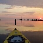
Your Name / Boat Name:14' Kayak

==============

TRIP OVERVIEW

==============

Date(s): 9/11/2009

Time on Water: 7: AM - 1:00 PM

Weather/Temp: partly cloudy & cool

Wind Speed/Direction: NE 5-10

Waves: 2'

Surface Temp: 52

Location: Near Maxwell Creek

===============

FISHING RESULTS

===============

Total Hits: 0

====================

SUMMARY & FURTHER DETAILS

====================

Saw a post on LOU that sounded like the lake had flipped. Checked the internet this morning to see if I could confirm this. The Michigan Sea Grant Coastwatch page showed temps in the high 60's (but also showed probable clouds). I wouldn't have gone bass fishing if I knew the lake had flipped but it looked to be a good day so I went.

When I got on the lake the surface temp was 52. I decided to head for deeper water and troll for trout and salmon with my fly rod and deep sinking line. I paddled out to 125' deep water and never marked any bait or fish. Surface temp a couple miles out was 58. The breeze started to increase and the swells got big enough to convince me to paddle back to bass depths. I had a nice ride but didn't find any fish.

What do others use as a source to determine surface temp and lake upwelling prior to heading out? My source isn't always too reliable...

Posted

first sign is the weather and the 2nd is a down temp probe, seen it coming last week with temps moveing up 20ft a day it kind of rolled slower than most time when it happens over night , should bring the mature salmon closer too shore for there run look out if we get some good rain !

Posted

FB7 –

Go to a site like this for your area and find the nearshore temp: (bottom of page)

http://weather.noaa.gov/cgi-bin/fmtbltn ... loz043.txt

Then go to this site and click on the different times shown (backward) to get an idea what is happening. Also go to forecasts & check out what they think is going to be happening.

http://www.glerl.noaa.gov/res/glcfs/glc ... pe=N&hr=00

It’s usually not a matter of the lake flipping but rather local upwellings

Tom B.

(LongLine)

Posted

Thanks for the replies.

Motoman, since I am fishing from a kayak, I don't usually venture out far enough to find the trout and salmon during mid summer and don't have a down temp probe. But now know that when people on this forum speak of an upwelling I have a better idea of why the surface temp maps on the internet may not yet show it happening.

LongLine, thanks for the links!

Jude

Posted

yep you got it , slap a battery and a fish finder on the front of ur yak and and hang some riggers on the back , you'll get em

Posted

I have a fishfinder with GPS on the yak. I just don't go far enough to find the fish. I usually limit myself to bass fishing since they are within reach. Today I logged 9 miles on the kayak and only managed to get out to 125 feet of water. Maybe when the fish get in a bit closer I'll get some!!

Posted

We've been catching the kings all season in the 70 - 120 fow range, so they're within reach for you. When an upwelling does occur, get a set of planer boards out and run the riggers shallow with long leads. Then vary your paddling speed and direction and you'll hook up! 8)

Create an account or sign in to comment

You need to be a member in order to leave a comment

Create an account

Sign up for a new account in our community. It's easy!

Register a new account

Sign in

Already have an account? Sign in here.

Sign In Now
×
×
  • Create New...