Jump to content

Recommended Posts

Posted
12 minutes ago, Frogger said:


".some how we have to get on the same page".


Sent from my iPhone using Lake Ontario United mobile app

That right there is at the heart of it. Have to put vested interests aside and work together. Unfortunately we have only to look at the functioning of our dysfunctional state and federal governments in terms of the probability of that happening. It is sad.

  • Like 1
Posted

Shummer said there has been 1.5 million allotted for a study . 


I'll save them a lot of money . 


Here is my study.


The lake is to high , lower it any way possible , now . 

  • Like 2
Posted

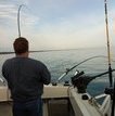
Just a quick post for those that doubted my claims last week that ice was just days away below the dam on the St. Lawrence.  This photo is from yesterday, if you look closely that's the moses Saunders dam in the background to the far right.

Screenshot_20191222-194405_Facebook.jpg

  • Like 1
Posted

Nice fish. Yes, ice forms near shore first.  Hope you told your friend to get off the ice...as just a couple days are all that's needed: (19th & 20th)


835262026_ships18.thumb.jpg.34bbc1dd8f0802d598055d29449ecf01.jpg


Here's a USGS chart so you can see the years' history & you can extrapolate the above:

1919993936_ships16.thumb.jpg.04510b8796c2b629f9714f00bee99142.jpg

Highest ever let out was 378K, (approx. 35-40 yrs ago)  Max this year was 364K.


BTW, the Ottawa was back to normal in June.


Tom B.

(LongLine)


Posted
50 minutes ago, LongLine said:

Nice fish. Yes, ice forms near shore first.  Hope you told your friend to get off the ice...as just a couple days are all that's needed: (19th & 20th)


835262026_ships18.thumb.jpg.34bbc1dd8f0802d598055d29449ecf01.jpg


Here's a USGS chart so you can see the years' history & you can extrapolate the above:

1919993936_ships16.thumb.jpg.04510b8796c2b629f9714f00bee99142.jpg

Highest ever let out was 378K, (approx. 35-40 yrs ago)  Max this year was 364K.


BTW, the Ottawa was back to normal in June.


Tom B.

(LongLine)


Yup, ottawa was back to normal in June as rivers tend to do after spring flooding.  Just as the outflows were increased to safe maximums as it receded as ur chart shows.  In fact that was the only time in your chart that flows were actually "reduced".  Since we are going to start bringing numbers into the conversation, trust me I've read them all in this case, let's bring the correct numbers into the conversation.  We actually spent most of the summer at 367,270k.  Although your single day record number of 378k is correct (1993) it only actually happened for very brief periods on 3 separate days during that year.  (Extreme west winds combined with high water)  Previous recorded sustained flows were 364k which were in place most of the summer in 2017.  This summer they actually increased flows another 200 cubic meters from 10,200 (364k) to 10,400 (367k).  Now keep in mind this number is calculated by including all water that passes through the Moses Sauders power dam, water that passes over the spillway at the Long Sault dam, the massena diversion and the diversion at the raisin river.  Those flows arent possible in the winter, they wont let water come over the spillways and bust up the ice below the long sault. Flows have been up over norms and even historical highs since the Ottawa receded in june.  Current levels are safe maximums and are right in line if not higher with what has always been practiced.


Last but not least since you knowledge even extends to the guy in the photos ice conditions.  4 inches of solid ice where hes at in the photo and ice is shore to shore right there.

Posted
You actually believe that slowing the flow in the st Lawrence and lake Ontarios water level has any impact on the water levels on the other great lakes?  What do u think they are slowing down Niagara falls?  Is this actually what u believe?  Please take the time to research how the system works before replying again.  That's embarrassing.  


It absolutely will. There is less back pressure on the water and it will flow faster if you pull the plug. This is simple hydraulics. Pull the plug down stream and they will all drop.


Sent from my iPhone using Lake Ontario United
Posted


It absolutely will. There is less back pressure on the water and it will flow faster if you pull the plug. This is simple hydraulics. Pull the plug down stream and they will all drop.


Sent from my iPhone using Lake Ontario United
Back pressure..... On Niagara falls.. A water fall. Ur saying the height of Lake Ontario effects how fast the water plummets 167' to the area below. You may want to rethink that. Simple hydraulics. Merry Christmas boys.

Sent from my SM-G965U using Tapatalk

  • Like 1
Posted
4 minutes ago, Gill-T said:

Water is coming down Welland Canal.  

A lock system.  Again separated by waterfalls between walls and drops that equal 167' and in zero way effected by the height of lake Ontario.

  • Like 1
Posted
On 12/25/2019 at 9:44 AM, iiwhistlerii said:

Back pressure..... On Niagara falls.. A water fall. Ur saying the height of Lake Ontario effects how fast the water plummets 167' to the area below. You may want to rethink that. Simple hydraulics. Merry Christmas boys.

Sent from my SM-G965U using Tapatalk
 

yea didn't think that one thru.  lol  happy new year. 


  • Like 1
Posted
The water level of lake Ontario has zero bearing on the rest of the great lakes.  We can stop debating this now.  Its fact.

No debate there the water level in LO and SLR is our concern. As Oberon said “ plans within plans within plans “ we are at the mercy of the money [emoji383]


Sent from my iPhone using Lake Ontario United mobile app
Posted

The Saint Lawrence River was the scene of docks rendered unusable due to high waters there. Property damage figures need to be adjusted to add the the Lake damages.

Posted

A historical fact that seems to be being completely ignored in this discussion is that the seaway was built for shipping and hydropower generation.  So that shipping and hydropower get major consideration in recent operation is only the way that it should be as that was the justification for the expenditure for the project to begin with.  That some lakefront property owners enjoyed flood control benefits from the narrowed range of lake stage that obtained from the opening in 1959-60 until recently is lagniappe, a 'little extra', but was not the primary intended purpose of the project.  Certainly, when fiscal compensation for high water damages came up in discussion with an IJC commissioner, she indicated that the prior benefits received by the maintenance of lower levels had already compensated lake shore owners. 

Posted

So the flow rates were cut back starting on August 21st. according to the IJC website.  There was no flooding on Montreal, The Ottawa was not flooding, there was no ice forming, but the flows were cut.  Yes the currents were ripping downstream of the dam and ships had to be careful navigating parts of the river but more could have been done. 

Posted

Dear Lucky 13. You mentioned "That some lakefront property owners enjoyed flood control benefits from the narrowed range of lake stage that obtained from the opening in 1959-60 until recently is lagniappe, a 'little extra', but was not the primary intended purpose of the project.  


Having a famiky cottage in the SLR for over 80 years I understand the the history of the shipping interest etc. However family homes, cottages and business were on the river long before the seaway opened up. So I feel that the incredible profits made with hydro and shipping since 1959-1960 should be shared.


And "a little extra help" ? My friend we are most likely going to lose our cottage forever. I'm not blaming anyone. I just think some people need  to understand the devistation this has brought to both Canada and the US. 6000 people in Montreal displaced. It's heartbreaking. Marina's jobs homes etc. For me personally  It's hard to read your post.  Like this is something so black and white. We have heard so many different interpretations of why we are at this point it's maddening.


So let's cross our fingers for the best. Merry Christmas everyone. Can't wait to get the boat in the water. Tying leaders today 👍


  • Like 1
Posted (edited)
26 minutes ago, Bustersit said:

. Can't wait to get the boat in the water. Tying leaders today 👍


:smile: I've been sharpening all my fillet knives on my new electric knife sharpener and mulling over the putting together of the new smoker:lol: My ice fishing stuff is already in the vehicle:lol:

Edited by Sk8man
Posted

Look we have to "live with it" the conditions on the lake now. Improve the boat ramps and docks that float will allow lake access.Then we can go fishing. Property and home owners made their  decision to buy onto the waterfront have to make their own decisions whether to improve their shore or just wait till the lower water levels return.

Create an account or sign in to comment

You need to be a member in order to leave a comment

Create an account

Sign up for a new account in our community. It's easy!

Register a new account

Sign in

Already have an account? Sign in here.

Sign In Now
×
×
  • Create New...